Africa–Japan Research Collaboration Advances Digital Public Infrastructure for Human–Nature Security and Resilience in Africa through the Geospatial Risk Index Tool (GSRIT)
A new Africa–Japan research collaboration is laying the scientific and technological foundation for addressing some of Africa’s most pressing environmental and security challenges through geospatial innovation and Digital Public Infrastructure (DPI).
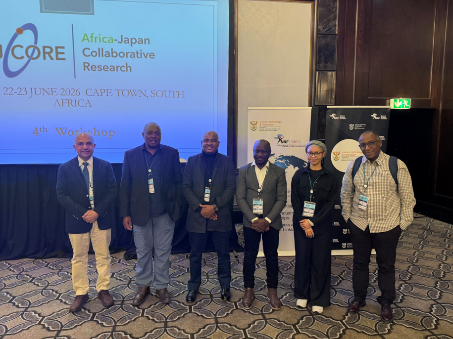
At the center of this effort is the AJCORE–GSRIT (Geo-Spatial Risk Index Tool) Project, an international collaborative research initiative between Wildlife Training and Research Institute (WTRI),Kenya, Hokkaido University Japan, Botswana Open University and University of University of KwaZulu-Natal (UKZN) and Remote Sensing Technology Center of Japan (RESTEC) focused on developing advanced geospatial tools to monitor and address human–nature conflicts, poaching, illegal wildlife trade, and climate change impacts across Africa.
The project is supported through the Africa–Japan Collaborative Research (AJCORE) framework, bringing together support from the Japan Science and Technology Agency (JST), the Kenya National Research Fund (NRF), the National Research Foundation of South Africa (NRF), and the Botswana Research Fund (BNRF). Through this partnership, the initiative combines scientific excellence, digital innovation, and regional collaboration to generate practical solutions for environmental governance and sustainable development.
Using advanced remote sensing technologies, Earth observation data, Geographic Information Systems (GIS), and field-based information, GSRIT is a geospatial platform that integrates multiple spatial and non-spatial datasets into actionable intelligence products. The project is designed to support local communities, conservation practitioners, researchers, and policymakers with improved environmental monitoring and evidence-based decision making.
Initial implementation activities focus on Kenya, Botswana and South Africa, where the tool is being developed to strengthen monitoring and response mechanisms related to human–wildlife conflict, agropastoral tensions, illegal wildlife trade, land encroachment, and climate-related environmental risks.
The AJCORE–GSRIT initiative directly aligns with the broader Digital Public Infrastructure (DPI) for Human–Nature Security and Resilience in Africa agenda championed jointly by Kenya and Japan.
This vision was showcased at the DPI–Africa event held during TICAD 9, where African leaders, technical experts, regional institutions, development partners, and Japanese stakeholders highlighted the role of digital transformation in strengthening resilience across the continent. In his keynote address, H.E. Hon. Dr. William Ruto, President of the Republic of Kenya, underscored the importance of innovation, regional cooperation, and data-driven approaches for protecting livelihoods, conserving biodiversity, and creating opportunities for future generations.
One of the major outcomes of the event was the announcement of the proposed establishment of a Digital Public Infrastructure (DPI) and Regional Command and Control Centre for Addressing Human–Nature Conflicts in Africa, to be anchored in Nairobi, Kenya. This was officially confirmed by Ms. Rebecca Miano, the Cabinet Secretary of Ministry of Tourism and Wildlife of Kenya during the DPI-Africa side event at TICAD 9.
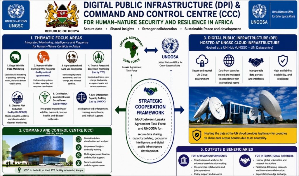
Framework of the Regional Digital Public Infrastructure Project
The proposed DPI platform will utilize a secure UN-hosted cloud environment to support cross-border collaboration and coordinated responses to climate change, biodiversity loss, human–wildlife conflict, poaching, illegal trade, and other transboundary environmental challenges. By integrating Digital Public Goods (DPGs), geospatial intelligence, and regional data systems, the initiative seeks to transform how Africa anticipates, monitors, and responds to nature-related risks.
Beyond operational coordination, the Regional Command and Control Centre is envisioned as a regional hub for research and innovation, providing access to primary datasets and advanced analytical infrastructure for leading academic institutions while creating opportunities for African researchers and young professionals.
Together, AJCORE–GSRIT and DPI–Africa demonstrate how research, digital public infrastructure, and international cooperation can create a more resilient and sustainable future for people and nature across Africa.